The National Hurricane Center is watching a region for tropical development in the Eastern Pacific this week. If a tropical storm forms, it would be named Alvin.
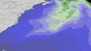
It’s a rinse and repeat pattern for the South as more rounds of heavy rain will impact the region. While storms are possible from Texas to Florida, the areas with the biggest risk for severe weather Tuesday are in western and central Texas, and southern Mississippi, Alabama and Georgia. Places like San Antonio, Texas; Montgomery and Mobile, Alabama; and Columbus, Georgia, could see strong storms with damaging winds and the potential for very large hail (2+ inches in diameter). An isolated tornado can’t be ruled out either. We could see more widespread storms in places like Houston, Austin, New Orleans and Atlanta. Watch to time out when these storms could arrive.
The Memorial Day holiday weekend brought severe storms to Texas’s Big Country, knocking out power to tens of thousands of people. Watch this video to see the tornadoes that swept across a field near Abilene, and hail bigger than a softball, that pounded a town near Lubbock.
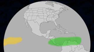
There are some hints in long-range models as to when we may see the 2025 Atlantic hurricane season's first storm, Andrea. Here's when that could happen, where it might form and historical perspective.