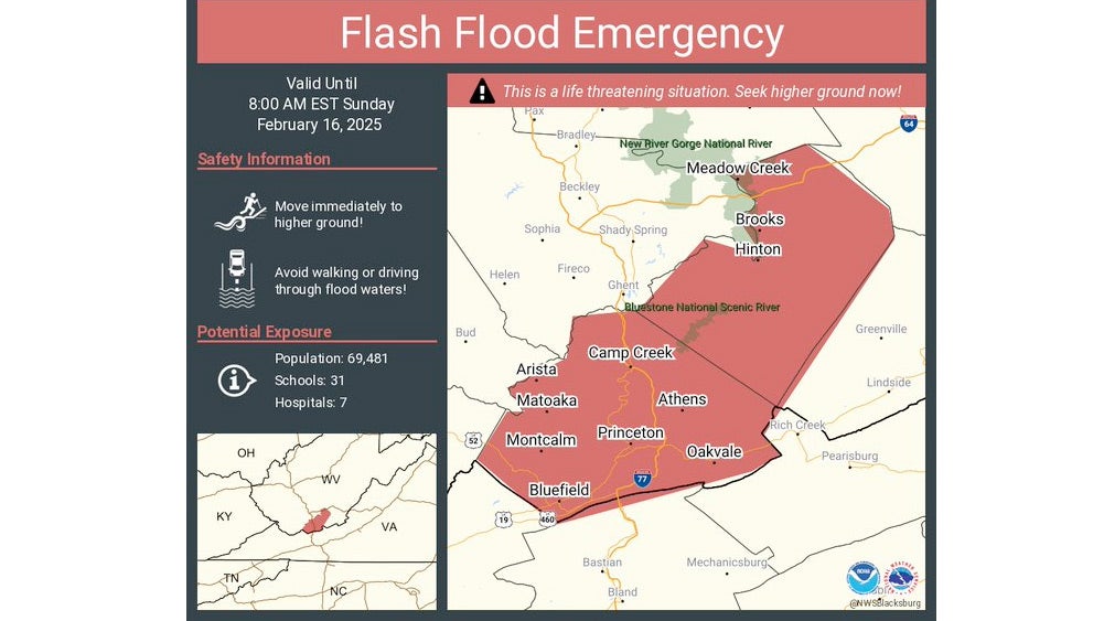
Particularly Dangerous Flooding Event To Pummel South, Ohio Valley
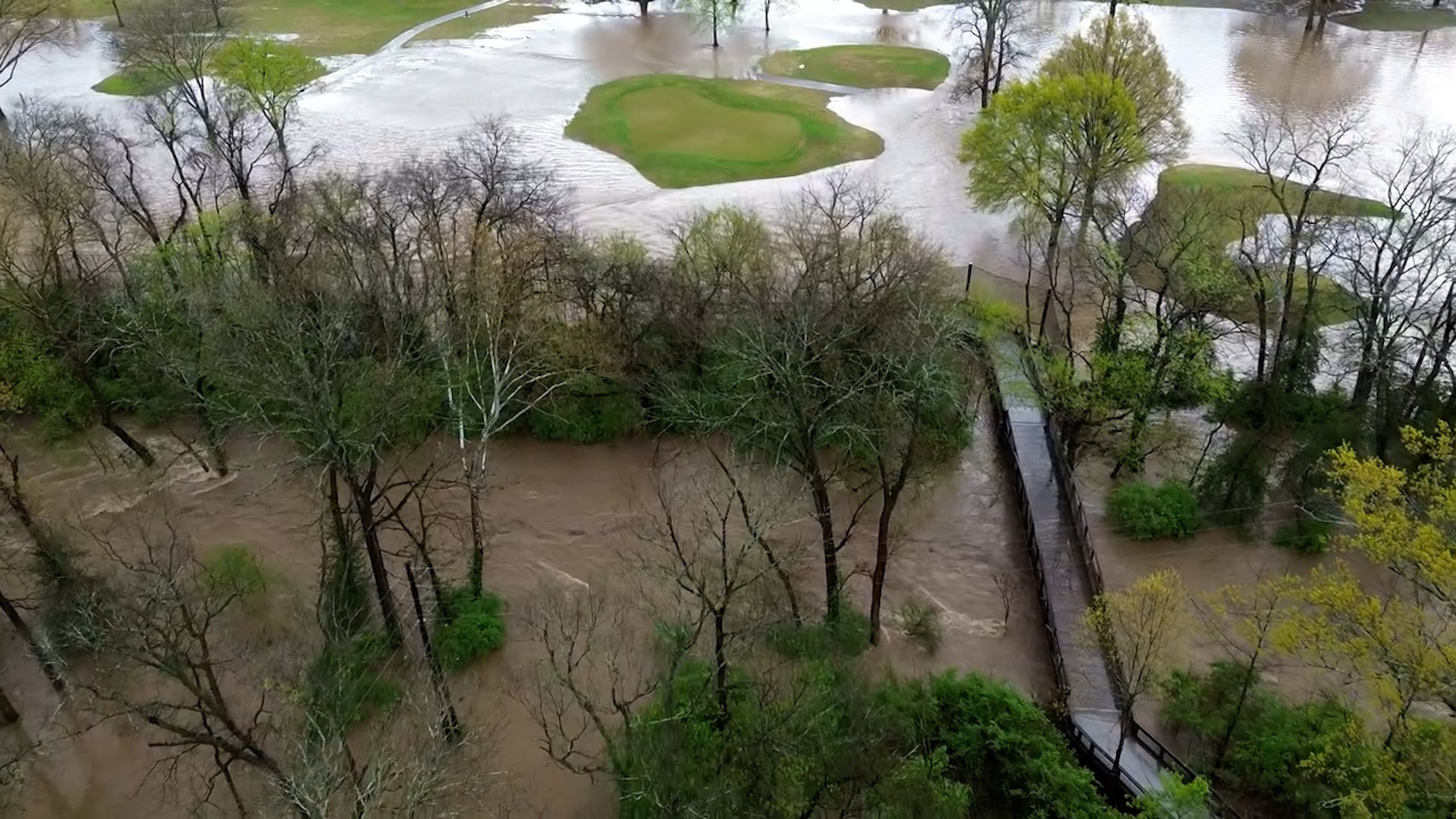
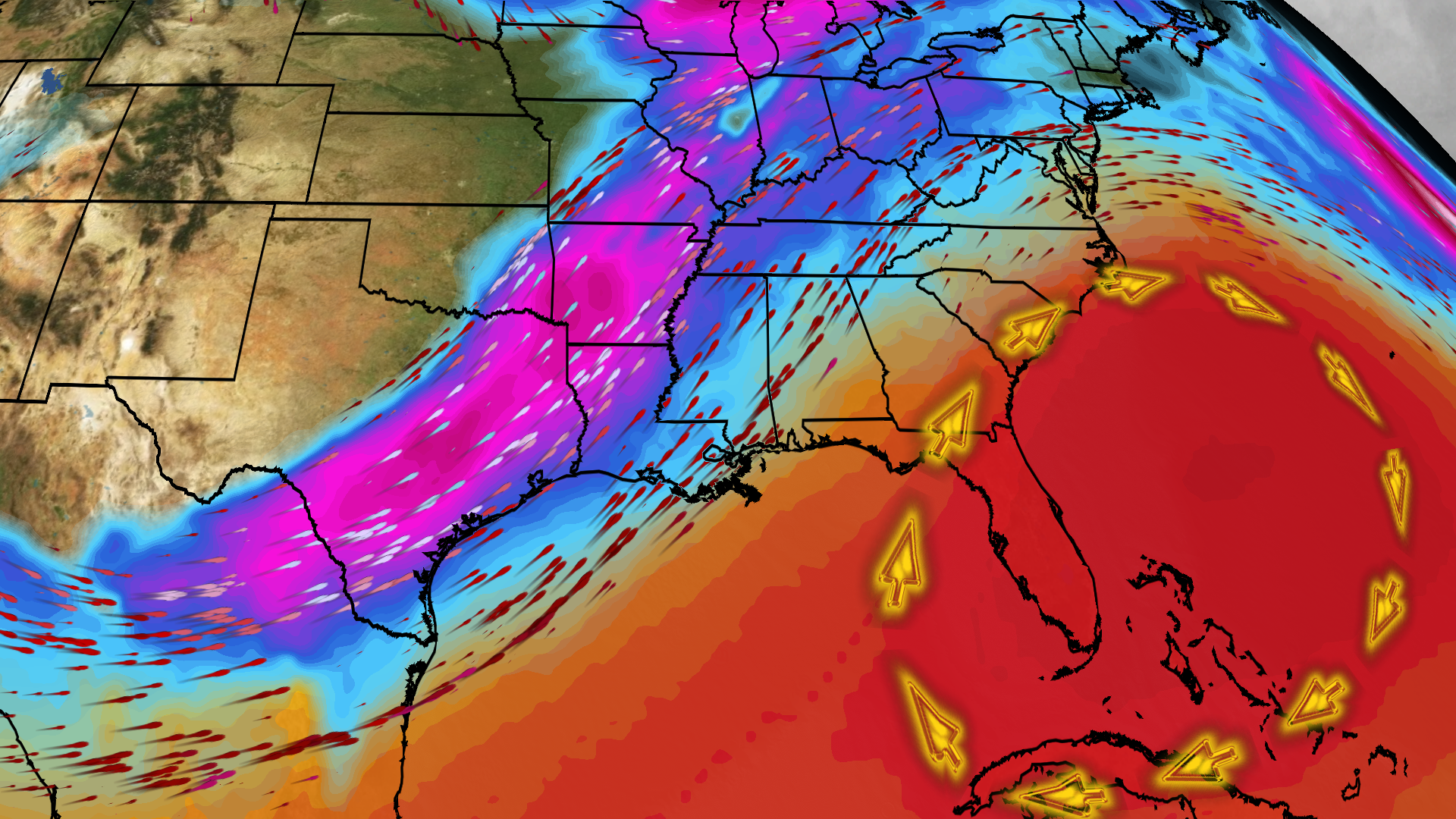
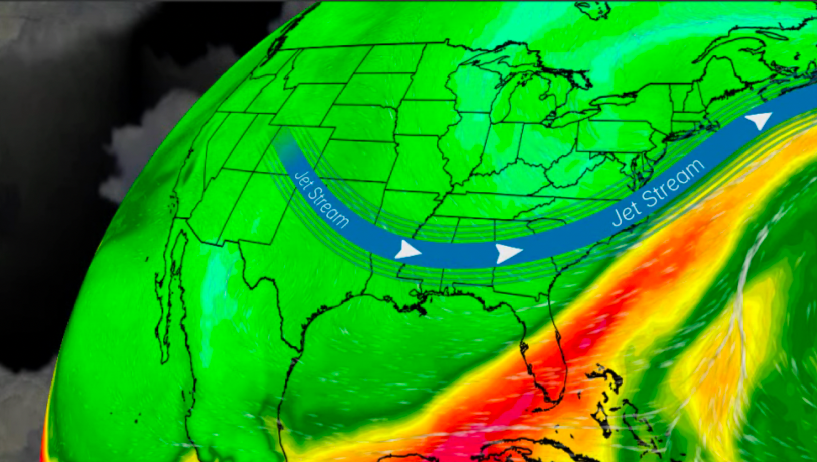
Life-threatening flash flooding will continue and major river flooding will develop from the South into the Ohio Valley this weekend. Severe storms could also produce tornadoes, wind damage and large hail, especially in parts of the South.